
Finding a Monmouth County Street
A street-by-street search in Monmouth County begins with the physical parcel, not a name list. The Monmouth County Clerk's property tools connect a municipality and address to a current owner, mailing address, situs location, assessment clues, sales information, and block, lot, or qualifier where available. Those fields help distinguish two similar road names or two parcels with the same owner. A mailing address is only a contact clue. It can differ from the property location, so it should not be treated as proof that someone lives at the parcel.
- Enter the municipality and the address, or a street name or part of one, in the OPRS consolidated property search. Save the situs, owner, and parcel identifiers returned.
- Use the map route or Monmouth County GIS context to place the parcel on the street and inspect the adjacent parcel geometry.
- Search the current owner or a likely prior owner in the recorded-document index, keeping the municipality and block and lot details in view.
- For a voter question, use the person-oriented state confirmation tool or ask the Commissioner of Registration about the lawful district-list route. It is not an open street browser.
- For an older address, consult the Red Bank and Monmouth County historical directory collections to see whether a reverse or criss-cross entry exists for that year.
That order keeps the research grounded in address-keyed sources. It also makes it easier to notice a split parcel, a changed street label, or a historic entry that needs more proof.
OPRS Searches for Monmouth County Streets
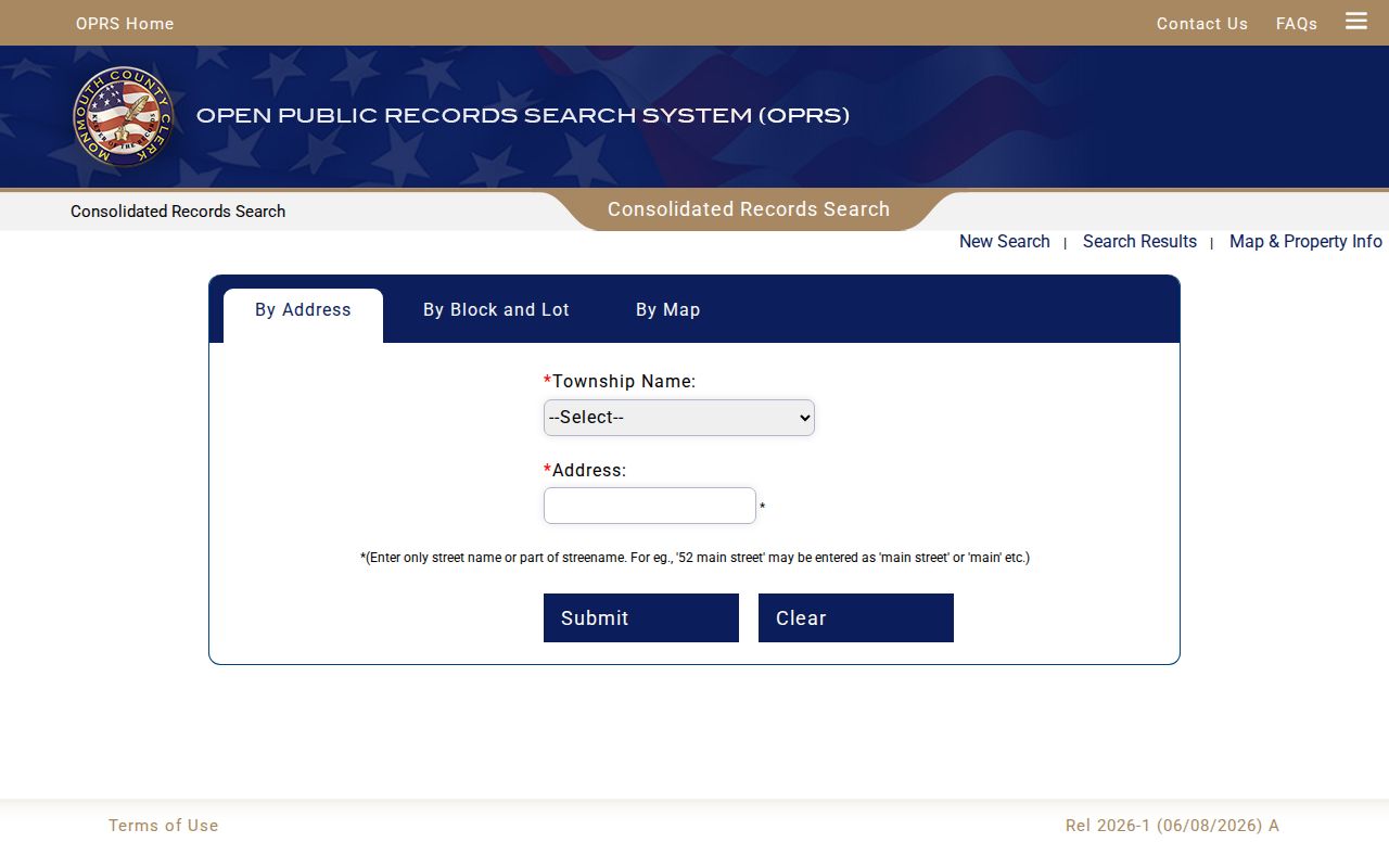
Monmouth County OPRS consolidated property search has separate routes for address, owner, block and lot, and map research. Its address instructions favor a street name or even part of a name instead of assuming a full street number will be the best match. The owner route is useful after a parcel is identified, while the block, lot, and qualifier route can bridge a changed address. The map route relies on zooming and right-clicking a property for details.
| OPRS route | Entry field | How it narrows a street search |
|---|---|---|
| Address | Township Name and Address | Selects the municipality, then accepts a street name or part of one. |
| Owner | Township Name and Owner Name | Finds a current owner after the parcel gives a name clue. |
| Block and lot | Township Name, Block, Lot, Qualifier | Uses the parcel identifiers that can outlast a street-label change. |
| Map | Zoom and right-click | Places the property in its map context and opens parcel details. |
The official property-search screen shows the separate entry paths used in this workflow.
Use the returned parcel details as a starting point, then compare them with recorded documents and municipal records instead of relying on one screen alone.
Note: Municipal assessors remain the proper contact for an assessment-specific question or a correction to local assessment information.
Monmouth County Street Record Coverage
Several Monmouth County record sets are keyed to an address or parcel, but they answer different questions. Monmouth County OPRS and municipal tax records identify property context. The deed and mortgage indexes record transactions. GIS explains where a parcel sits. A permit file may document work or a certificate, while historical directories can supply an older address-to-name clue. The table separates those uses so a record is not asked to prove more than it can.
| Address record | Custodian | Useful street detail | Access route |
|---|---|---|---|
| MOD-IV and tax list | County and municipal tax offices through OPRS | Owner, mailing and situs locations, assessment, parcel, and possible exemptions | Property search; municipal assessor for corrections |
| Sales data | County Clerk through OPRS | Grantor, grantee, price, date, book or page, and square footage | OPRS archive |
| Deed and mortgage index | Monmouth County Clerk | Parties, recording data, legal description, amount or consideration, and property identifiers | Online index and image; certified copy through the Clerk |
| Tax map and GIS | County Board of Taxation, GIS, and GeoHub | Parcel geometry, block and lot, map sheet, and layers | OPRS, GIS viewer, or map download; not a survey |
| Permit or code file | Municipal building or code office | Applications, plans, certificates, or violations where retained | Municipal custodian or OPRA request |
For a modern address check, the parcel identifier is the best bridge between these sources. For an older address, compare the deed's legal description and tax maps before assuming the same road label points to the same property.
Read a Monmouth County Parcel
A Monmouth County parcel card may show a current owner, mailing address, situs location, assessment, sales information, tax-map reference, and the block, lot, and qualifier. The distinction between the two addresses matters. Situs describes the physical property. Mailing describes where tax correspondence can go. Neither field identifies every person associated with that address, and statewide parcel products intentionally omit some owner names under Daniel's Law.
- Parcel
- A mapped property unit identified for tax and land-record purposes.
- Situs address
- The physical property location used in tax and property records.
- Plat or tax map
- A mapped representation of parcels and identifiers, useful for context but not a survey.
- Criss-cross directory
- A historical address-first directory that can point from a street entry to an occupant for a particular year.
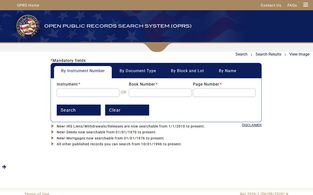
The Monmouth County OPRS custom search offers recorded-document controls for instrument, document type, block and lot, and party-name paths. Name searching accepts the percent sign as a wildcard, and document-date searches are limited to 90 days. Record the search date and the query form used, especially when a common surname or a street rename is involved.
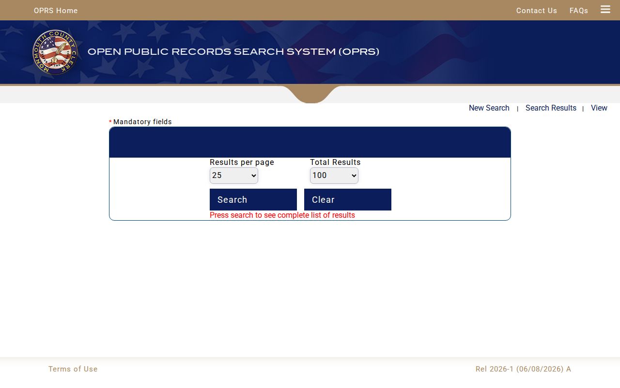
These controls support a focused document search after an address-derived parcel or owner clue has been verified.
Map a Monmouth County Street
Monmouth County GIS and GeoHub are navigation tools for street-by-street research, not proof of title. The Monmouth County mapping description supports searches by county or municipality, parcel identifier, block, lot and qualifier, owner name, or street address. Map layers can add parcel boundaries, recent sales and tax-appeal context, plus flood, wetlands, contaminated-sites, hazardous-sites, and other environmental information. Those layers help explain the geography of a road, but they do not establish who occupies a home.
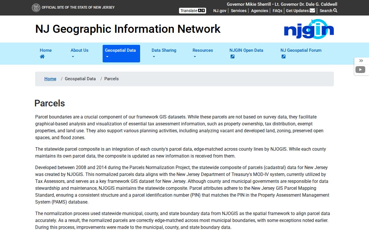
The statewide NJGIN parcel resources offer another way to cross-check parcel geometry with address, county, municipality, block, and lot inputs. They redact owner names in hosted statewide parcel and tax-list products under Daniel's Law, and they caution that parcel boundaries are reasonable representations rather than surveys.
The NJGIN parcel page illustrates the statewide map and data route used alongside Monmouth County sources.
When a road passes through a shore neighborhood, rural tract, or former installation area, use the parcel's municipality and legal situs to resolve the location instead of relying only on a mailing label.
Note: GIS parcel lines add map context, but a deed, survey, or certified record controls the legal question.
Deeds Along Monmouth County Streets
After Monmouth County OPRS identifies a current parcel and owner, the recorded-document index can reveal the purchase deed. Search the likely grantee with the municipality and a relevant date range, then verify the instrument number or book and page, recording date, document type, block and lot, and legal description. On a deed image, the grantor and grantee, consideration, property address, and metes-and-bounds details can help decide whether the document belongs to the same parcel. Search the seller as an earlier grantee to move back through the chain.
Monmouth County OPRS publishes deeds from January 1, 1970 forward, mortgages from January 1, 1976 forward, and other published records from October 1, 1996 forward. The index is informational rather than a warranted title search. For title research, the Monmouth County Clerk directs researchers to the Freehold office. Ordinary electronic copies are free and in-office copies are five cents per page; a certified copy carries the stated certification and page charges, which should be confirmed with the Clerk before payment.
The Monmouth County Clerk's recorded-document search provides the deed, mortgage, party-name, and block-and-lot paths used to follow a street parcel.
For a certified copy, an earlier record, or a question the online index cannot settle, use the Clerk's in-person, letter, or email request route rather than treating the image as an official seal.
Monmouth County Street Voter Limits
The New Jersey voter registration check is person-oriented. It uses first name, last name, date of birth, and county inputs to confirm registration information, and the state advises trying the exact county spelling, spacing, hyphenation, middle initial, or marriage name. It is not a public street roster, and a match or non-match should not be treated as proof of a person's present physical occupancy.
New Jersey's voter-list statute, N.J.S.A. 19:31-31 through 19:31-39, permits an electronic list of any or all election districts from the Commissioner of Registration at reproduction cost, with a stated statutory maximum of $375. The Commissioner, Christopher Siciliano, is at 300 Halls Mill Road in Freehold, with a published phone number of 732-431-7780. Protected addresses, signatures, Social Security numbers, driver information, and ballot choices are not public. Ask the county election officials for the current request format and lawful-use conditions.
Note: A voter record can help confirm a county registration question, but it does not identify every person at a street address.
Monmouth County Street Permit Files
Permit and code records belong with the municipality that created them. A Freehold ordinance provides a concrete Monmouth County example: the building inspector keeps permit applications, special-condition permits, and plans, while monthly reports summarize permits, certificates, and violations. A certificate-of-occupancy copy goes to the owner or authorized agent. Other Monmouth County municipalities can have different retention and request practices, and the research did not locate a countywide permit-search portal.
Send an OPRA request to the local building, code, or clerk custodian when the relevant municipality is known. New Jersey's Open Public Records Act is codified at N.J.S.A. 47:1A-1 et seq.; the state's OPRA request guidance explains the custodian-based route. Give the full address, municipality, date range, and record category so the custodian can identify the files.
Red Bank Street Entries
For a past Monmouth County household clue, the Red Bank Local History Room and DigiFind-It hold city directories from 1938 through 1981. A reverse or criss-cross directory can run from an address to a listed occupant, while the ordinary portion runs from a name to an address. Read neighboring entries in the printed street sequence and keep the publication year, page, abbreviations, and address convention with the note. A missing listing is a gap in a particular source, not proof that nobody was there.
The Monmouth County city directory collections explain the broader historical runs, library access, and the difference between a directory entry and current evidence. Pair a historical street entry with a tax-map year, a deed legal description, or census timing before connecting it to a present-day parcel.
Note: Historical address directories are date-specific records, so compare their year and locality label before carrying a name forward.
OPRS Is Not a Title Search
Research tip. OPRS is a fast way to assemble the identifiers needed for a careful Monmouth County street directory search, but the Monmouth County Clerk expressly says it is not warranted as a title search. Use it to locate a deed, mortgage, tax-map image, or sales clue. Then compare the document's municipality, parties, legal description, and parcel fields. A map line, a familiar street name, or a single owner-name result is not enough to resolve a legal ownership question.
If a sensitive recorded address needs redaction rather than more searching, use the Clerk's OPRA/redaction request form. The published form accepts up to three instrument descriptions and states a $10 request fee with an average seven-working-day response, subject to possible special-service, prepayment, or deposit charges. Daniel's Law can also explain why an owner name is missing from statewide parcel material.
Monmouth County Street Directory Limits
Address records can connect public parcel, deed, map, permit, and historical-directory evidence. They cannot reveal every household member, delivery customer, private utility account, motor-vehicle address, sealed court matter, adoption record, or protected address. Statewide NJGIN owner redactions, the Address Confidentiality Program, Daniel's Law, and voter-record exclusions are intentional privacy boundaries. A parcel owner also is not a complete list of people who may use or be associated with a property.
Lawful use. Use address records for personal, lawful research and civic or historical questions. Do not use them to stalk, harass, intimidate, or harm anyone.