
Monmouth County ZIP Code Coverage
The Monmouth County official list supplies Monmouth-focused postal labels as well as a separate group of surrounding-area entries. It does not provide a complete station or postmaster crosswalk for every row, so the Monmouth County post-office column below notes the county's wording rather than guessing a station name. Verify an individual delivery address with USPS before using a postal label to choose a Monmouth County municipal or parcel search.
| ZIP | Areas covered on county list | Post office | Record-search note |
|---|---|---|---|
| 07701 | Red Bank | Station not supplied | Borough or area mailing label |
| 07702 | Shrewsbury | Station not supplied | Shrewsbury-area delivery |
| 07703 | Fort Monmouth | Station not supplied | Installation or area label |
| 07704 | Fair Haven | Station not supplied | Locality label |
| 07710 | Adelphia | Station not supplied | Howell-area locality |
| 07711 | Allenhurst, Loch Arbour | Station not supplied | Shared shore-area labels |
| 07712 | Asbury Park, Interlaken, Ocean | Station not supplied | Shared municipality and locality labels |
| 07716 | Atlantic Highlands | Station not supplied | Locality label |
| 07717 | Avon by the Sea | Station not supplied | Locality label |
| 07718 | Belford | Station not supplied | Middletown-area locality |
| 07719 | Belmar, South Belmar, Wall | Station not supplied | Crosses municipal labels |
| 07720 | Bradley Beach | Station not supplied | Locality label |
| 07721 | Cliffwood | Station not supplied | Aberdeen and Matawan-area locality |
| 07722 | Colts Neck | Station not supplied | Locality label |
| 07723 | Deal | Station not supplied | Locality label |
| 07724 | Eatontown, Elberon | Station not supplied | Shared municipality and locality labels |
| 07726 | Manalapan, Englishtown | Station not supplied | Shared municipality and locality labels |
| 07727 | Allaire, Farmingdale | Station not supplied | Shared locality and borough labels |
| 07728 | Freehold | Station not supplied | County-seat area label |
| 07730 | Hazlet | Station not supplied | Locality label |
| 07731 | Howell | Station not supplied | Locality label |
| 07732 | Highlands, Fort Hancock | Station not supplied | Shared shore and installation labels |
| 07733 | Holmdel | Station not supplied | Locality label |
| 07734 | Keansburg | Station not supplied | Bayshore locality |
| 07735 | Keyport, Cliffwood Beach | Station not supplied | Shared locality labels |
| 07737 | Leonardo | Station not supplied | Middletown-area locality |
| 07738 | Lincroft | Station not supplied | Middletown-area locality |
| 07739 | Little Silver | Station not supplied | Locality label |
| 07740 | Long Branch, West End | Station not supplied | City and neighborhood labels |
| 07746 | Marlboro | Station not supplied | Locality label |
| 07747 | Matawan | Station not supplied | Locality label |
| 07748 | Middletown, New Monmouth | Station not supplied | Shared municipality and locality labels |
| 07750 | Monmouth Beach | Station not supplied | Locality label |
| 07751 | Morganville | Station not supplied | Marlboro-area locality |
| 07752 | Navesink | Station not supplied | Middletown-area locality |
| 07753 | Neptune, Neptune City | Station not supplied | Shared municipality labels |
| 07754 | Main Office Boxes | Main Office Boxes | Special mailing context, not a parcel neighborhood |
| 07755 | Oakhurst | Station not supplied | Ocean Township locality |
| 07756 | Ocean Grove | Station not supplied | Neptune-area locality |
| 07757 | Oceanport | Station not supplied | Locality label |
| 07758 | Port Monmouth | Station not supplied | Middletown-area locality |
| 07760 | Rumson, Sea Bright | Station not supplied | Shared shore-area labels |
| 07762 | Spring Lake, Spring Lake Heights | Station not supplied | Shared labels |
| 07763 | Tennent | Station not supplied | Manalapan-area locality |
| 07764 | West Long Branch | Station not supplied | Locality label |
| 07765 | Wickatunk | Station not supplied | Marlboro and Manalapan-area locality |
| 07799 | Eatontown Postal Facility | Eatontown Postal Facility | Facility context, not ordinary street evidence |
The Monmouth County ZIP listing is the source for the locality associations shown above.
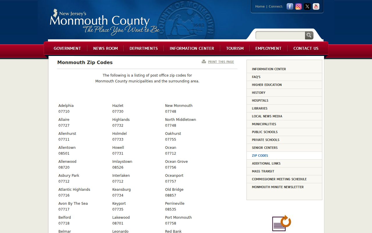
The Monmouth County page also shows nearby entries such as Allentown, Clarksburg, Cream Ridge, Imlaystown, New Egypt, Perrineville, Roosevelt, Allenwood, Brielle, Manasquan, Sea Girt, Old Bridge, and Lakewood. Treat those as surrounding-area delivery geography where applicable, not as a silent expansion of the Monmouth County list.
Special Monmouth County Postal ZIPs
Two Monmouth County entries need a different reading. The Monmouth County list displays 07754 as Main Office Boxes and 07799 as the Eatontown Postal Facility. Neither should be treated as evidence that a person or a parcel is in a conventional neighborhood. A box or facility label may be the right mailing detail, but it does not establish a Monmouth County street location, a municipal tax jurisdiction, or a current place of residence.
The USPS Postmaster Finder by ZIP is the appropriate next step when the station or post-office relationship needs checking. Monmouth County research did not locate an official source that supplied a complete station-name crosswalk for all listed entries.
The USPS Finder is shown here as the source for checking a postal office by its ZIP.
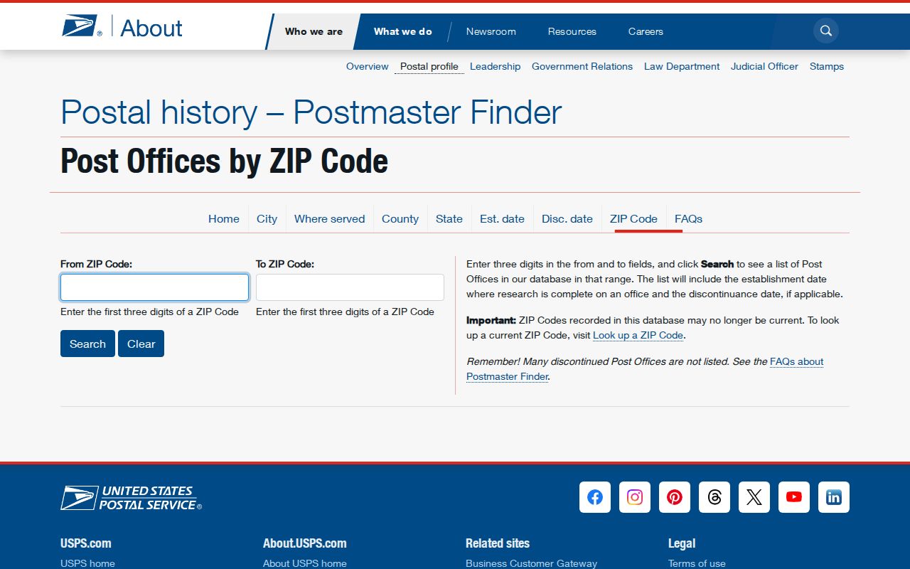
Use the finder to verify the postal-office relationship, then return to municipal or Monmouth County property records for an address-level question.
Finding Residents Within One ZIP
A ZIP can narrow the place name, but the official sources reviewed do not show a Monmouth County OPRS property filter or public voter browser that lists people by postal area. The practical Monmouth County workflow is to validate the delivery code first, identify the associated municipality, and then use the local record tool that actually accepts the available address, owner, or parcel inputs. That prevents a broad Monmouth County postal label from becoming an inaccurate resident roster.
- Use USPS address tools to confirm the five-digit code and, when needed, the ZIP+4 for the exact address.
- Compare the postal locality with the Monmouth County list, then identify the municipality that holds the property and local records.
- Search Monmouth County OPRS by municipality and address, owner, block and lot, or map route. Do not assume a postal label is a property-search field.
- Use the state voter confirmation tool for a specific person or ask the Commissioner of Registration about the statutory district-list route; it is not a ZIP-wide public roster.
- Once the municipality and road are known, continue with the Monmouth County street directory for the address-keyed parcel and deed workflow.
For Monmouth County or municipal records that are not online, send a focused request to the custodian that holds them. New Jersey OPRA requests go to the relevant custodian, and the municipality, address, date range, and record category should be stated plainly.
USPS Checks for Monmouth Mail
The USPS AIS Viewer supplies the exact-address checks that the Monmouth County table cannot. Its available functions include City and State, County Retrieval, Delivery Statistics, ZIP+4, and Address Lookup. An individual lookup can verify the five-digit code, ZIP+4, carrier route, county code, delivery point, and check digit. These are delivery facts, so they should be paired with Monmouth County or municipal records for parcel and jurisdiction questions.
| USPS tool entry | What it can verify | Use in county research |
|---|---|---|
| City and State | Postal locality context | Checks the mailing label before selecting a municipal record source. |
| County Retrieval | County association | Helps separate postal geography from a municipality or parcel situs. |
| ZIP+4 and Address Lookup | Five-digit code, ZIP+4, delivery point, and check digit | Verifies one delivery address before any address-keyed record search. |
| Delivery Statistics | Postal delivery data | Provides postal context, not proof of a household or property owner. |
The AIS Viewer is the official address-verification source pictured below.
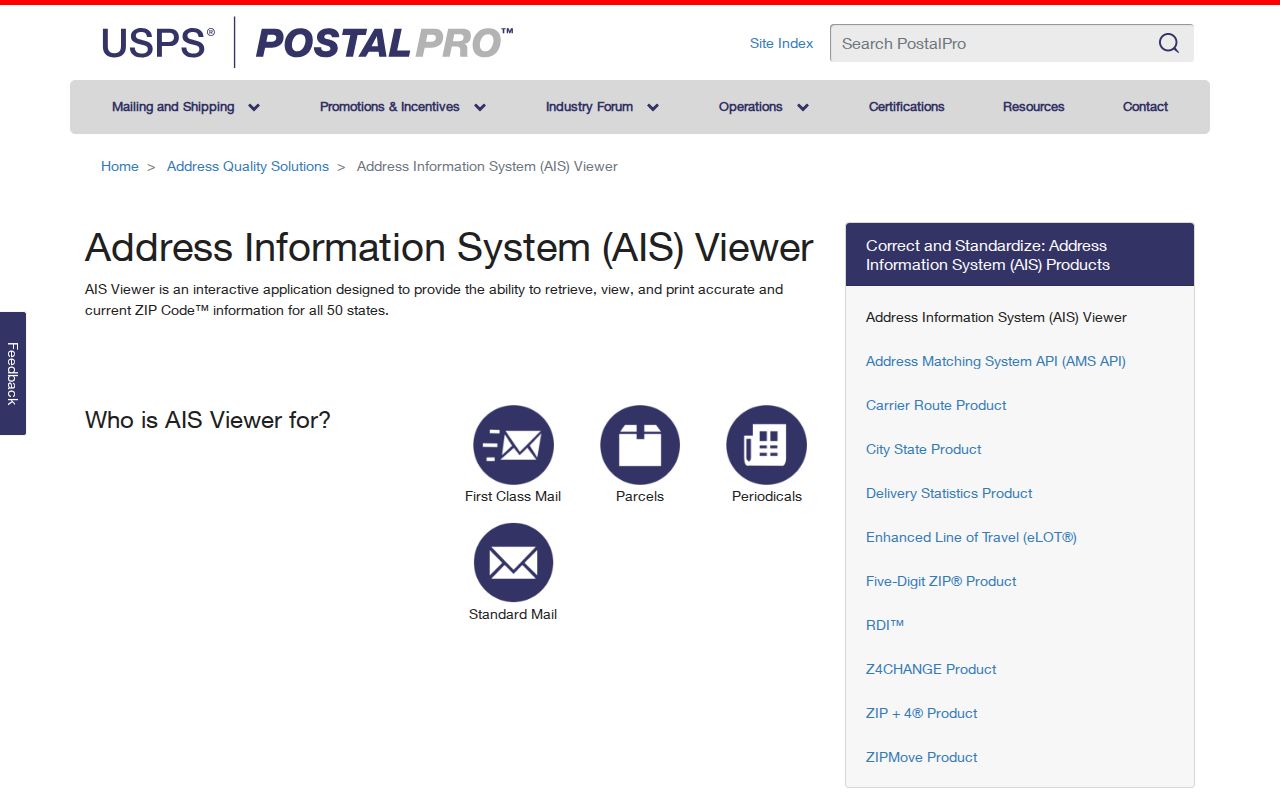
Its result can settle a delivery-code question without settling ownership, municipal jurisdiction, or the identity of everyone associated with an address.
USPS also explains address standardization and ZIP+4 structure in its ZIP basics guidance, which is useful before beginning a Monmouth County property search.
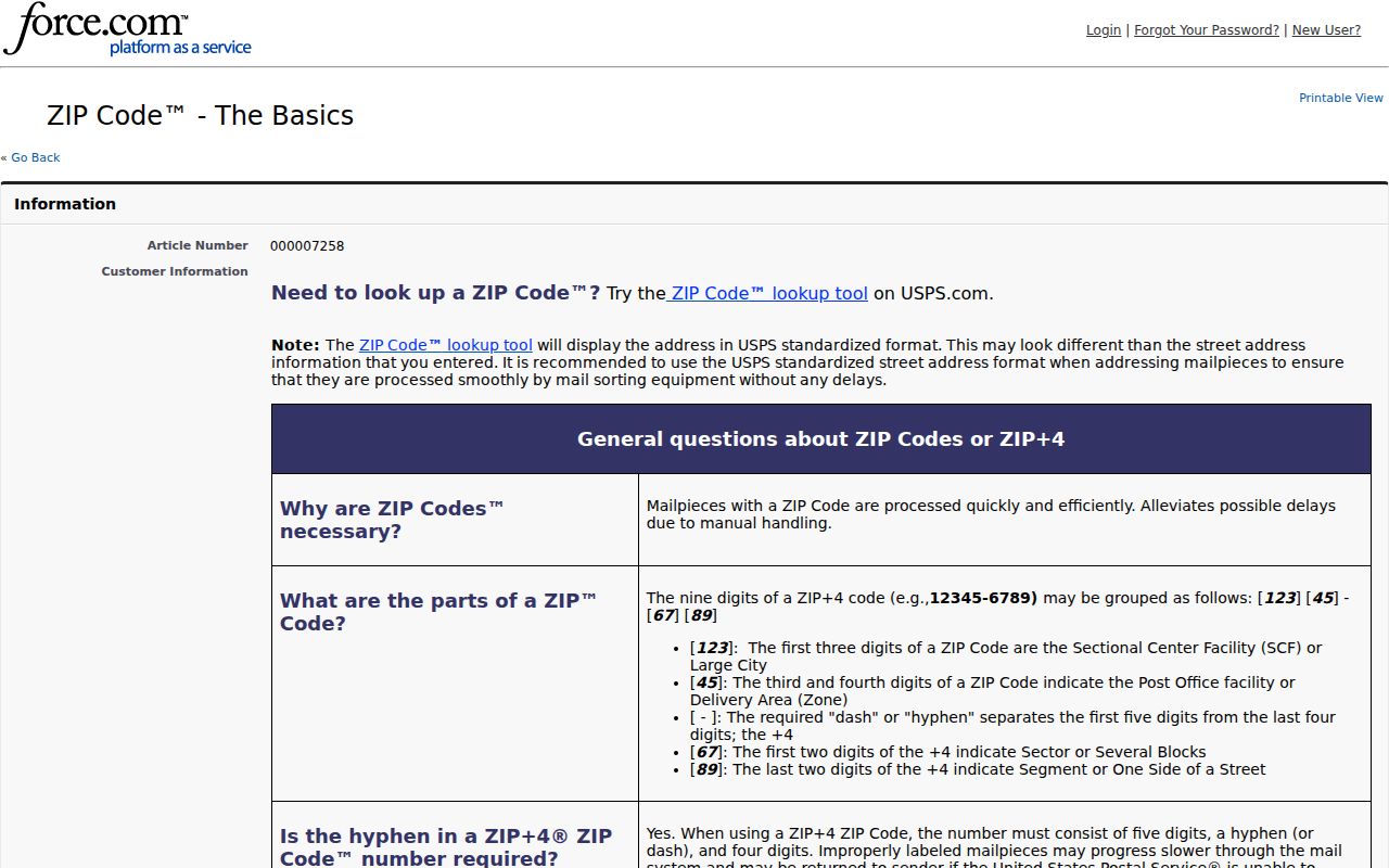
Use that guidance when formatting a mailing address, while keeping the parcel's local identifiers in a separate research note.
Monmouth ZIP Codes and City Limits
Property situs, block and lot, and tax-map references are Monmouth County or municipal concepts. USPS assigns the delivery ZIP and ZIP+4. The research did not locate one countywide E911 or readdressing authority that governs every local situation. When a delivery label conflicts with a parcel record, use the Monmouth County municipality, the tax parcel, the legal description, and the responsible municipal clerk to resolve the record question. GIS parcel lines add useful context, but they are not a survey.
- ZIP and ZIP+4
- The five-digit delivery code identifies a delivery area; the added four digits refine the delivery point or route for an address.
- PO-box ZIP
- A code used for post-office boxes or office-box service, not proof of a street parcel.
- Unique ZIP
- A special postal context tied to a facility or organization; the county source identifies 07799 as an Eatontown Postal Facility entry.
- Carrier route
- A delivery-route designation that helps USPS sort mail and does not define a municipal boundary.
Note: A block and lot or a deed legal description can preserve parcel continuity better than a street label after an address changes.
Monmouth County Parcel Address Checks
After USPS confirms the delivery address, the Monmouth County OPRS consolidated property search can be used with township and address, owner name, block and lot, or map inputs. It may show the current owner, mailing address, property location, assessment, sales clues, and tax-map references. The mailing field can be useful for locating a record, but it may differ from situs and should not be treated as a residence assertion.
The Monmouth County GIS route adds parcel geometry and map layers. For a statewide geometry cross-check, NJGIN parcel resources accept address, county, municipality, block, and lot inputs, while redacting owner names under Daniel's Law. This division of functions is deliberate: postal tools verify mail delivery, Monmouth County tools provide locally held parcel context, and statewide map data supports spatial review.
Monmouth County ZIP Code Directory Limits
Monmouth County postal geography is not a directory of every person in a delivery area. Postal service data, a property owner record, a voter confirmation result, and a historical address listing all have different scope. Protected addresses, DMV information, private utility and delivery-customer records, sealed matters, and other confidential information are not open sources for a postal-area search. New Jersey's Daniel's Law can also explain an owner redaction in statewide parcel data.
Lawful use. Use postal and public-record information for personal, lawful research. Do not use it to stalk, harass, intimidate, or harm anyone.